


Iceland Maps And Direction
Beschreibung von Iceland Maps And Direction
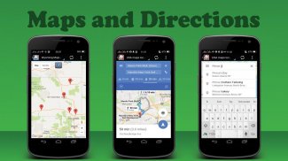
Maps, Navigation, Street directions and Useful app your trips in Iceland
Iceland Maps Lets you know the maps, street Directions and plan your trips in Iceland, route your travel and find hotels nearby. Find your current location or search for an address and navigate using googlemaps your destination.
Maps include information, Maps view mode, satellite view or even street view in Iceland States.
You can find city, satellite, traffic, public transit, cycling or even hiking maps that you want in Iceland of , you can always find your location with Maps & Street Directions!
Travel around the Iceland and navigate using any transportation method:
- Route planner for cars, bikes and walking to any address in Iceland
- Street directions with local traffic help you find the fastest trip route
- travel directions from the most trusted maps
- Location tracker via latitude & longitude
- Navigation maps with googlemaps for city, traffic and public transport routes
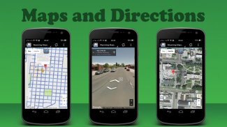
Maps range from satellite maps to bike maps and street view are also available:
- Street view – See exteriors for museums, restaurants and more
- Traffic maps – See current traffic conditions to avoid traffic jams
- Cycling map with bike routes and contour lines - Plan your next cycling tour
- Walking maps – Explore your city on-foot with detailed walk-friendly maps
- Hiking GPS – Find hiking trails or plan your next backpacking trip
- Maps, Navigation & Directions uses googlemaps and Open Street Map
Get Directions and Maps for every Towns & Cities in Iceland
- Bus routes & tracker, Get directions and maps
- Train station locations
- Bike paths for cycling
- Subway maps and stations
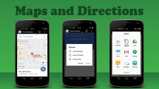
Search to Find places in Iceland:
Food near you, Hotels, Bars near you, Gas stations, ATMs, Addresses, street name & house number, city etc, Nearby city and neighborhood zip codes, Seacrh Places around your locations, Find hotels, restaurants, shopping, museums, stations, hospitals etc
Iceland Maps FEATURES
Ways to get around anywhere: Explore your city on dozens of maps, including worldwide, street, satellite, traffic, public transit, cycling, walking and hiking maps.
Karten, Navigation, Straßenrichtungen und nützliche App Ihre Ausflüge in Island
Island Maps können Sie kennen die Karten, Straße Anfahrt und planen Sie Ihre Ausflüge in Island, Route Ihrer Reise und Sie nach Hotels in der Nähe. Finden Sie Ihren aktuellen Standort oder nach einer Adresse suchen und navigieren Googlemap Ihr Ziel verwenden.
Karten enthalten Informationen, Karten View-Modus, Satelliten-Ansicht oder sogar Blick auf der Straße in Island Staaten.
Sie können Stadt, Satellit, Verkehr, öffentliche Verkehrsmittel, Fahrrad fahren oder auch Wanderkarten finden, die Sie in Island wünschen von, können Sie immer Ihren Standort mit Google Maps & Street Wegbeschreibung finden!
Reisen Sie um die Island und navigieren jede Transportmethode:
- Routenplaner für Autos, Fahrräder und zu Fuß zu jeder Adresse in Island
- Straße Richtungen mit den lokalen Verkehr Hilfe finden Sie die schnellste Fahrtroute
- Fahrtrichtung von den vertrauenswürdigsten Karten
- Location Tracker über Breite und Länge
- Navigationskarten mit Googlemaps für Stadt, Verkehr und öffentliche Verkehrswege
Karten reichen von Satellitenkarten zu Radkarten und Blick auf die Straße sind ebenfalls erhältlich:
- Street View - Siehe Außen für Museen, Restaurants und vieles mehr
- Verkehrskarten - Siehe aktuelle Verkehrssituation um Staus zu vermeiden
- Fahrradkarte mit Radrouten und Konturlinien - Planen Sie Ihre nächste Radtour
- Wanderkarten - Entdecken Sie Ihre Stadt auf Fuß mit detaillierten Spaziergang freundlichen Karten
- Wandern GPS - Finden Sie Wanderwege oder planen Sie Ihre nächste Wanderreise
- Karten, Navigation & Anfahrt verwendet Googlemaps und Open Street Map
Anfahrts und Karten für alle Städte und Dörfer in Island
- Buslinien & tracker, Anfahrtsweg und Karten
- Bahnhof Orte
- Radwege für Radfahrer
- U-Bahn-Karten und Stationen
Suchen finden Orte in Island:
Lebensmittel in der Nähe von Ihnen, Hotels, Bars in der Nähe von Ihnen, Tankstellen, Geldautomaten, Adressen, Straßennamen und Hausnummer, Stadt usw., Nahe gelegene Stadt und Nachbarschaft Postleitzahlen, seacrh Orte um Ihre Standorte, Finden Sie Hotels, Restaurants, Einkaufsmöglichkeiten, Museen, Bahnhöfe, Krankenhäuser usw.
Island Karten FEATURES
Möglichkeiten, um irgendwo hin zu kommen: Entdecken Sie Ihre Stadt auf Dutzenden von Karten, einschließlich weltweit, Straße, Satellit, Verkehr, öffentliche Verkehrsmittel, Radfahren, Wandern und Wanderkarten.
Iceland Maps And Direction – Version 1.0
(19-05-2020)Iceland Maps And Direction – APK Informationen
APK Version: 1.0Paket: us.mapsanddirections.icelandmapsNeueste Version von Iceland Maps And Direction


Apps in derselben Kategorie

Das könnte dir auch gefallen...


